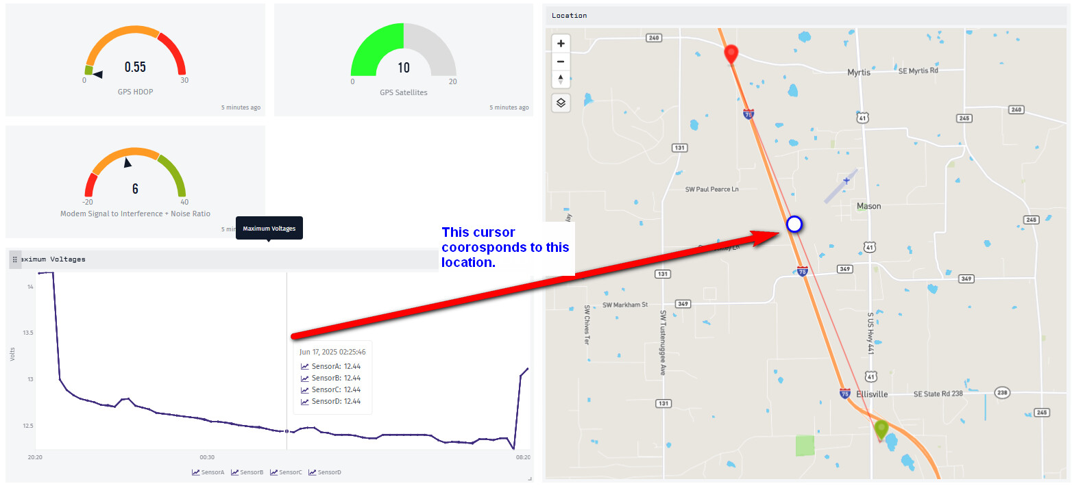
I review our data daily, and leverage the multi-plot cursor heavily. At times, I’d like to know the GPS location of my device when I’m hovering over a plot data point. I can zoom around to get to that location, but it would be a great feature if there was an icon moving around while I hover over my data.
Thanks, I’ll file that as a feature request. It falls in with a similar feature where we sync the tooltips between different time series graphs and Custom HMTL Blocks.
In fact, you might be able to accomplish what you are after right now in a Google Maps Custom HTML Block, because the block can subscribe to tooltipChange events. I don’t have a working example but the pieces are there to pursue that.
Interesting. I’ll put in a Google Maps Dashboard integration task on our backlog. I’ve been pretty pleased with the ease of use of the native map block, but perhaps it would be a worthwhile enhancement as we begin to leverage location more heavily. Thanks Dylan.